17 years helping Singaporean businesses
choose better software
CARTO
What Is CARTO?
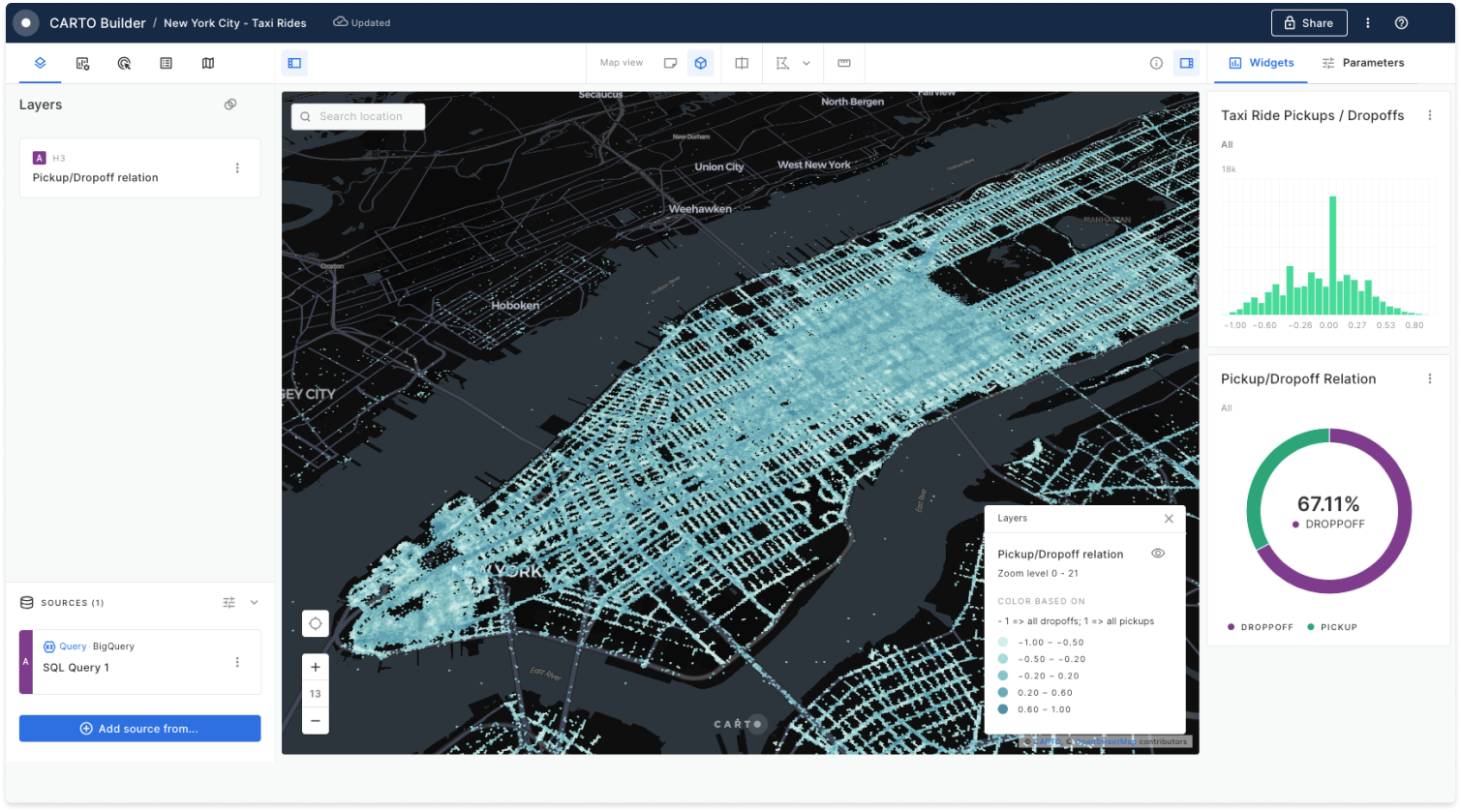
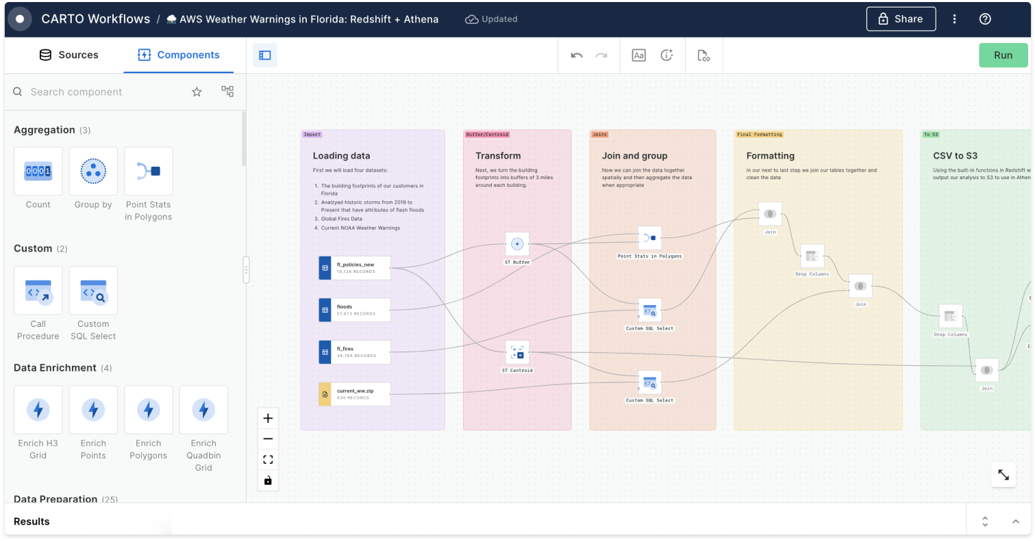
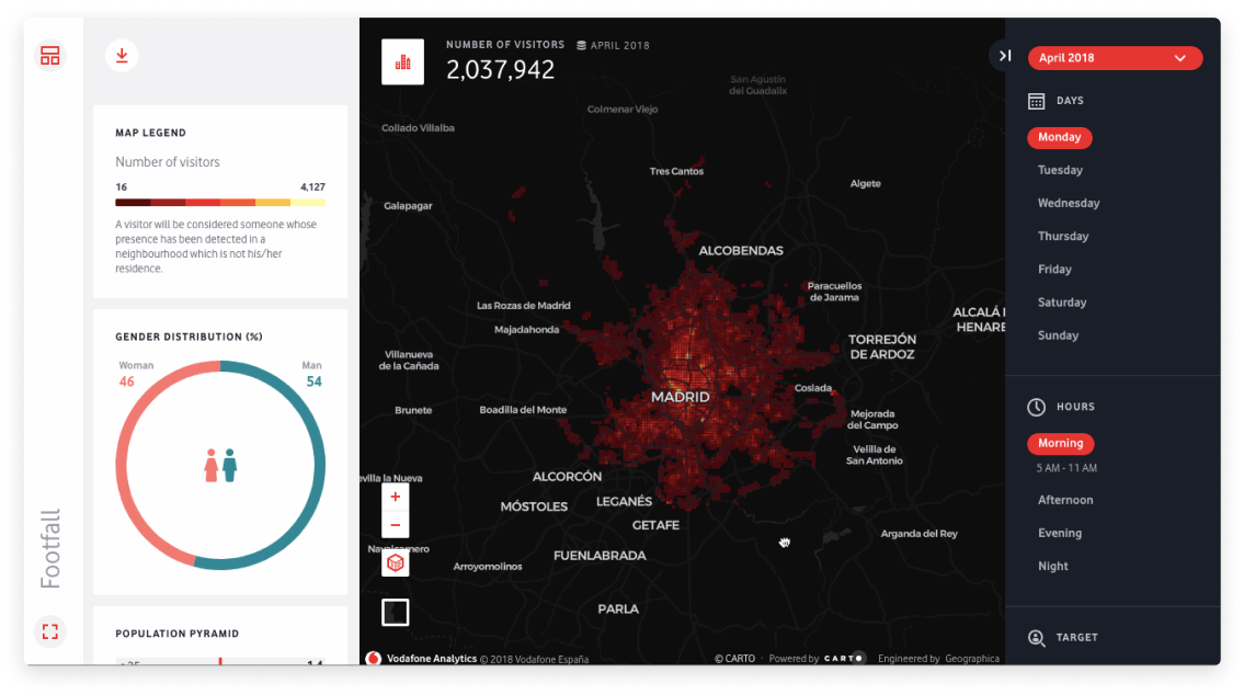
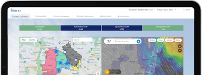
From smartphones to connected cars, location data is changing the way we live and the way we run businesses. Everything happens somewhere, but visualizing data to see where things are isn’t the same as understanding why they happen there. CARTO is the world’s leading cloud-native Location Intelligence platform, enabling organizations to use spatial data and analysis for more efficient delivery routes, better behavioral marketing, strategic store placements, and much more.
CARTO is trusted by top leaders like Coca-Cola, Vodafone, JLL, Deliveroo, and more. Data Scientists, Developers, and Analysts use CARTO to optimize business processes, and predict future outcomes through the power of Spatial Data Science.
Who Uses CARTO?
Telecoms, Insurance, CPG, Retail, Real Estate, Marketing & Advertising, Utilities, Environmental, Financial Services, Cities & Government, Transport & Logistics, Healthcare & Pharma, AEC.
Not sure about CARTO?
Compare with a popular alternative

CARTO
Reviews of CARTO

Carto. excellent tool to manage your maps
Comments: I carried out tests in the free version, the loading, data management and final products of the analysis were excellent.
Pros:
Carto presents a fairly intuitive learning management, allows analysis of the loaded data, you can perform hot spot analysis and easily adapts to geomarketing management. You can also perform ideal location analysis, offers webinars and documents to learn from the platform
Cons:
The cost of the license is medium, the trial period is very limited, it does not offer proposals aimed at students with few economic resources
The Best portable GIS
Comments: It is quite interesting to play with the layers and visualize the different Carto options, it is quite illustration software.
Pros:
Carto is perhaps the best GIS software in the cloud, because in addition to how easy it is to learn to use, its analytical capacity is great.
Cons:
It is very likely that if you do not have basic notions it will be difficult for you to understand how it works, thematic maps are great.
CARTO have been incredibly supportive . Their mapping software enables us to reach new demographics
Pros:
The customer support provided by CARTO is excellent. Rarely have I had the pleasure of working with a company that consistently provides help and support so quickly and readily. With regards to the software it enables us to display large datasets that we have created in a new visual format. This enables us to convey not only a huge amount of information but also global and complex issues in a user friendly and easy to digest format. The maps we have created using CARTO have been viewed over 26,000 times in a year which for us a relatively small NGO is fantastic. Especially as this new medium to display our data has been picked up by media sources due to the ease at which these maps can be shared enabling us to potentially reach a broader ranged demographic than with previous outputs. The latest version is much improved from the first incarnation with the ability to undo certain actions and to move data points with the click of a mouse without having to change manually the lat and long numbers.
Cons:
It can at times be rather clunky and slow to load, although this may be due to the number of data points within a map. Annoyingly with the latest version the ability to place a title on a map has been removed. Also the legends have a tendency to be very large and unmoveable whilst at the same time not able to accommodate titles over a certain length. The software is easy to pick up with trial and error but it is not immediately obvious what can be achieved and or displayed with the mapping software. I am sure that I have not been able to utilise all of the great functions there are available but I am not sure what is available. The widgets are a nice new addition but these again and large and have a tendency to cover large portions of the map. These could be slimmed down and also made obvious for the viewer that they could pull them up and reduce them in size to aid map understanding.
Best Digital Geospatial Mapping Experience Out There
Pros:
Ease of access and speed. For a digital mapping platform, Carto is a powerhouse of a client that is both intuitive and efficient (in time and resources). I am able to upload and operate datasets quickly (along with exporting full projects); and, customize the features with relative comfort - including adding and removing without too much complication. It is comparatively the best platform I've used in the years I've been mapping, and they have been among the most helpful hands on assistance when it comes to snafus while working.
Cons:
I've few criticisms that make me like Carto less; but, the most significant one I could think of: I wish there could be more than eight layers when designing maps, as there are times when it's critical to juxtapose many different layers in identifying and judging patterns.
I used Cartodb and now Carto for years to support a citizen participatory project on active mobility
Comments:
It is the main platform to centralize data from a citizen mapping open platform (repubikla.org), to manage datasets, make análisis, visualize and communicate assessments and civil monitoring to governments un several Mexican cities. The benefits is having an easy, clear, and all on one platform, with a large gain of Time.
I have a very good communication with collaborators with the webmaps, so we gain impact (track @repubikla #repubikla on twitter)
I'm also learning a lot, through database management and análisis frequent tasks.
Pros:
Carto is a very versatile platform, well integrated to the web and social network. It totally satisfy my needs as an open data activist, to centralize data from citizenship, make attractive visualizations and spread them through a large activists ecosystem on the web and social media. It also helps to communicate effectively the data and the analisis to governments. The good aspect is it has both beginners and advanced users interfaces. It was one of the reasons we selected this tool to allow the group work. The support given to users is very attentive.
Cons:
It could have even more flexible fonctions with no need to manage the code. For my use it is not necessary, but I guess that a way to custom OpenStreetMap Tiles would be very useful. As well, some link to "improve the OpenStreetMap basemap" (as used on many platforms) , is a good way yo interact with OSM and have shared benefits.
Great tool to visualize data
Pros:
It's a great tool to visualize geopositionated information
Cons:
The styling can be complicated on complex maps
Great addition to our organization
Pros:
It allows us to easily display data to our audience in an interactive and meaningful way. CARTO has made it much easier for us to use maps as a policy tool.
Cons:
The changes made to the legends system took a bit to get used to, but the Builder is getting better as more and more people use it. Can't wait for any improvements to come!
Carto gives me the opportunity to make all my maps and databases everywhere.
Comments: I get more job opportunities, since it's a very innovative product in the GIS enviroment.
Pros:
Styling capabilities, data processing, and dynamics. I like it because I can embed my beautiful maps everywhere, with many interactive functionalities. Also, the academy is awesome, there are many tutorials on how to build awesome stuff.
Cons:
The new version is very awesome but is not as intuitive as the first version. It has a lack of editing capabilities offered by other desktop GIS software. The number of layers allowed also limits a lot complex cartography. The free version has a lot to offer, but the price of the paid version of the service seems too high.
CARTO has helped us find new ways to visualize spatial data and connect analysis to a broad audience
Pros:
-CARTO is a great, user-friendly product that has greatly improved the way that we connect spatial data and analysis to a diverse set of non-technical stakeholders -Creates attractive maps with easy-to-use interface -Back-end development features are user friendly and easy to learn even with limited GIS or programming experience -The ability to edit in HTML and CSS gives the opportunity to customize the end product design and provides a high level of flexibility and control -CARTO is always innovating and adding new features and functionality
Cons:
-It would be nice if there were some expanded analytics on map usage -It would be helpful if there was additional documentation on how to use HTML or CSS in CARTO. Currently, users largely have to figure it out themselves.
Very friendly user and with several possibilities to categorize information and create nice maps
Comments: Make our technical information available on the internet.
Pros:
Our organization appreciates that the platform makes very technical information available to the community since it creates a bridge between the traditional geographical systems and the communication part of this information. It also has several and suitable options to categorize information, as well as to put layers, images, and text in the maps which is usually very difficult to incorporate in an online platform without coding.
Cons:
We would like the possibility to put more layers of information per map and more space for datasets.
We use Carto for our land acquisition planning as we are a Land Trust preserving open space.
Comments: It helps us to save more land.
Pros:
I think we use a limited amount of the software's capacity. We overlay parcel map data onto the carto platform and then use a key to code different types of properties.
I've used carto to make several multi-layered maps related to housing for my non-profit.
Pros:
I love carto. As someone with very little GIS knowledge I've been able to make amazingly interactive, informative maps using Carto's very intuitive program. I love the map's pop up features which you can make come up on a mouse hover or mouse click and give information about specific locations and layers in the map. I also have made good use of Carto's exiting library of GIS files.
Cons:
Carto includes several analysis tools that allow me to do some analysis even without GIS skills. One analysis tool I wish existed was one that would allow me to filter one layer by another. That's the one thing I haven't been able to figure out how to do in Carto.
Dependable and flexible way of making creative data maps.
Comments: We made some pretty engaging data maps using this software and government data.
Pros:
The software allows our organization to visualize geographic data in a powerful visual. We regularly make unique maps that can easily be embedded on our website and works great on mobile.
Cons:
I would say that the newest version of the software had some learning curves, but were easy to navigate once you kicked the tires.
Have enjoyed using Carto for a few years now. Helpful staff and a tool with powerful potential.
Pros:
Wide array of customization options to fit varying skill levels. If you're stuck on something odds are it isn't because you can't do it, but rather you have to learn something new and more challenging in order to do it.
Cons:
Learning curve can be a bit steep at first. Recent changes to the UI expanded the power of the tool, but made entry-level harder to navigate.
CARTO has enabled me to create several interactive maps to visually display data collected by my org
Pros:
Ease of Use: As I have limited official training in using mapping software, I appreciated how easy it was to learn how to use CARTO's software. It was very easy to create a map from existing data my organization had collected by importing excel spreadsheets. It was also easy to incorporate popup boxes into my maps to display additional qualitative data. Diverse Mapping Features: CARTO software has many features and options which allowed me to create several different types of maps. As my organization collects several different types of data, the CARTO software made it easy to create maps that displayed this information in a way that was logical and visually appealing. Easy to find additional information or tutorials online from external sources.
Cons:
The tutorials or technical information on CARTO's website is limited. When I sought to increase my technical capacity to use the CARTO software, I had to seek external sources. There is no option to change or modify the base maps provided by CARTO.
Powerful tool for map overlaying
Comments: It was kind of tricky to get it running smoothly, and we needed support for it. Once set, we got great results and exactly what we expected
Pros:
- Tons of maps and parameters customizations - Endless features and configurations, can perform almost everything - REST API - Good documentation
Cons:
- credentials system is tricky - how data is stored and managed is confusing and requieres lots of trial/error test - for large amounts of data you have to be careful in order to get good performance
Powerful and easy to use geospatial web platform
Comments: Interactive web maps to present our efforts on getting rid of explosive remnants of war.
Pros:
Powerful data visualizations and analysis and with a few click you are up and running. The styling, analysis, widgets and programming interface extend the capabilities of what you can do with the platform.
Cons:
More like suggestions than cons: the widgets need to support more data filter types such as drop downs and calendar date pick up fields and filters; also data exports to different formats.
Thank you Carto, Thank you executive
Pros:
I really enjoyed playing with this tool. I created 2-3 maps during my session with Carto in link with my job. I was a complete neophyte at 1st but with the help of the customer service and executive he helped me step by step to improve and make my maps even better.
Cons:
Really hard to use when you have no knowledge. Wish I entered in contact with [SENSITIVE CONTENT HIDDEN] earlier in my trial I would have had more time.
Carto makes web based GIS and interactive web mapping a breeze
Pros:
Drag & drop GIS data integration, robust APIs, their dashboard makes learning and using SQL easy, superb support staff & team.
Cons:
The new Builder interface takes some getting used to, but is super powerful once you learn it, and Carto has plenty of tutorials to help you get started.
Great, but very pricey
Comments: Looked into Carto several months ago to service some of our mapping needs.
Pros:
It looks slick, has lots of integrations, and is fairly flexible. It does a lot of what we want and the team was responsive and open to helping us with extra stuff.
Cons:
They're quite pricey for their offering. Google MyMaps gets you pretty far with mapping, and Carto is definitely better than Google MyMaps, but they charge a lot.
Made great maps easily. I was able to merge different datasets (shapefile and population data)
Comments: Fantastic Maps!
Pros:
I really like that the result looks very professional and it is very easy to do chloropleth maps. You can customise the maps and info windows a lot.
Cons:
I have not used the statistical functionalities of the software yet. I would like to make an animated map (torque map) but this seems to be a bit more complicated because data needs to be formatted specifically. Though Carto is great and I can do most of the things I need to do!
Great Cloud software for digital mapping
Pros:
CARTO takes digital mapping to a new level. It is cloud base, easy to use and fast to learn. Makes GIS mapping more interactive and easy to customize for different purposes.
Cons:
I used only the free trial but it was a great experience. Being open-source any issues you might have you'll find a solution online and also they keep adding new features.
CARTO has helped expand Literacy around Location Intelligence in Nigeria. Ease of use.
Comments: The software helped us teach young Nigerians easily about the basics of use of Location Intelligence
Pros:
The Ease of Use and the fact that it has free features that help young Nigerians create simple visualization and also Learn the basics of using Location Intelligence to visualize and analyze issues while it also raises their curiosity on solving problems.
Have primarily used Carto for easily bringing the geospatial power of PostGIS to the web.
Pros:
- The SQL API is extremely easy to use and opens many possibilities for web-based GIS. - The out-of-the box tools for geovisualization are beautiful. I haven't used much of these, but admire the visualizations I see published.
Cons:
The UI could be more straightforward. I don't spend much time in Builder, primarily using the APIs, but when I do it takes a little while to get the hang of it.
An excelent way to view GIS data
Pros:
It has a lot of tools for the analysis of the GIS data and visualize it , quick and easy
Cons:
At the begining it's dificult to get used about how it wokrs


